Awesome, we know that it is a favorite destination and often on peoples bucket lists, so this is why we have put together an itinerary with all the things you will want to do here!
Big Sur has a very rugged, dramatic coastline on the west, it has dramatic and enticing views of the Santa Lucia Mountains on the East, and so it is not difficult to see exactly why Big Sur often gets named as the “Greatest meeting of land and water”. It literally is!
It is 90 miles long, making it short enough for you to see it all, but long enough for an awesome road trip!
A Big Sur road trip is easily completed in less than two hours, going from San Simeon to Carmel.
However, with all this to see for mile after mile, and so many places to take stops and enjoy the views, you really want to dedicate a few days to this trip.
Otherwise, you might miss out on something awesome!
If you are still working on planning your trip to Big Sur, and you are trying to figure out where you should stop at, we have done most of the work for you, listing everything you need to know, and pin-pointing the must-sees on your journey.
If at least half of our mentions make it into your itinerary, then you have crafted an awesome getaway.
So, let’s get started shall we?
What Is ‘Big Sur’ Exactly?
For those of you who do not actually know exactly what Big Sur is, it is a mountainous and rugged section of the Central California Coastal highway, found between San Simeon and Carmel.
Most people tend to view it as being one of the most scenic driving routes in the US, perhaps in the world, which is why it is often on the bucket list of many Americans.
The drive along this highway is often described as ‘one of the best on Earth’, and is believed to be one of the top 10 for motorcycle rides in the United States as well.
It is also named as being the most popular drive in California as well! So, you can see why it is such a key location!
How Do You Travel To Big Sur?
In order to get to Big Sur, there are a few travel options.
You could fly, which is the most reasonable option for those on the Eastern Coast.
If you are flying, consider flying to San Jose airport as it is the closest airport to Big Sur.
However, if you fly into San Francisco or Los Angeles, they are further away (L.A. especially), but it still makes for a very fun road trip, and you can even treat your journey to Big Sur as a part of your road trip overall.
If you are treating Big Sur as a weekend trip (which we highly recommend), then you will want somewhere to stay, and in keeping with the kind of adventure you are on, you will probably want to stay at a cozy oceanfront cabin.
This place has 3 bedrooms, including a master suite with panoramic views as well as a queen bed, and a TV to go with it.
The kitchen is also fully equipped, so you can easily cook up a fast, yet hearty meal!
It is found on Monterey Band, so as well as enjoying all the typical scenery associated with Big Sur, you can enjoy shopping, hiking, wine tasting, and more!
It is the perfect place for you to enjoy the local area.
You can also drive 17-miles of the road from Monterey Bay to Carmel-by-the-Sea, and stay the night before you carry on your trip!
The Ultimate Big Sur Itinerary (ROAD TRIP!)
Aside from just taking the drive full of breathtaking views, there are also loads of things that you should do in Big Sur.
With so much for each type of traveler to enjoy, we have come up with a full list of all the best stops you should consider adding to your itinerary.
Our itinerary (as seen below) begins in Carmel and ends at Ragged Point. So it starts at the Northernmost point, and travels down South.
However, if you are planning a San Francisco to Big Sur trip, then there are a few other places you may want to stop off which we have not mentioned on this list.
These include:
Gilroy.
Daly City.
Monterey.
Santa Cruz.
Half Moon Bay.
If you wanted to, you could even add on San Luis Obispo, Santa Barbara, Morro Bay, and Pismo Beach to your list.
But, if you wanted to drive from San Diego in the South, we would recommend making this a 3-day road trip.
If you drive from Big Sur to San Francisco, and you want to use our itinerary, then simply invert it. This should be no problem at all!
Filled with picturesque cottages that wear blankets of flowers, thin streets of cobblestone, and cozy boutique shops, with local farm-to-table dining, this is a town that makes you feel like you are living in a fairy tale world!
As you walk through the European styled street of Carmel, you’ll feel like you are dreaming, and you will be enraptured by the sound of crashing waves as you venture through the town.
While you are in Carmel, you should make sure that you make the time to walk the streets, take in the scenery and admire its fairy tale like cottages, with timber detailing, fairy-styled chimneys, and high pitched roofs.
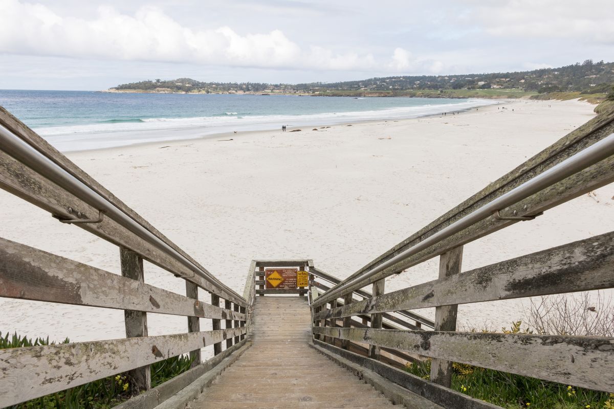
Carmel also has two very pretty beaches, while Carmel Beach itself is the primary beach, with a sandy shore with beautiful Cypress trees, and a gorgeous landscape for surfing and relaxing, the Carmel River State Beach should also be considered.
Carmel River State Beach is just around the corner and is a great alternative to the busier Carmel Beach.
It is 100% true that this location should mark the starting point of your Big Sur trip, which makes it perfect for stopping at and gathering any items you may need for the trip ahead, while taking in all the scenery of course!
While you are probably excited to hit the road as soon as possible, it is best to spend a day taking in the beauty of Carmel.
You will also want to make sure you fill up on gas, as while you can get gas in Monterey and Carmel, once you go further South, the next gas station won’t be until you are near to Pfeiffer Big Sur State Park, which is a good 30 minutes away!
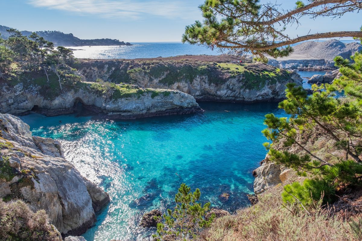
Not all that far away from Carmel is Point Lobos State Reserve, it is a beautiful park that has absolutely stunning views of the coast, it also has interesting flora, gorgeous coves, and a vast array of birds and marine life for you to look out for.
This location is often named the crown jewel of the California State Park System, and a day spent there is going to captivate anyone who visits.
One of the must-sees here is Gibson Beach, which is a beautiful beach donned in teal-shaded water, and is without a doubt one of the most beautiful beaches in Big Sur.
There is also China Cove, which is a beautiful spot that you should most-definitely check out.
Here you can get glimpses of a hidden cove that has jaw-dropping emerald green tones, and even better, you will often see seals hanging out in here!
You can gain access to the beach and the cove here if you follow the Bird Island Trail, which is a really beautiful park hike, maybe one of the most stunning in the whole of Big Sur.
This trail also leads to one of the most beautiful sights.
It shows you a viewpoint from which you can see Bird Island, which is a seasonal nesting area, one where you can catch glimpses of many seabird species that are simply going about their business.
However, you will only see this in summer and spring time.
You cannot access Bird Island itself, but it is the ideal spot from which to do some hardcore bird watching, so a pair of binoculars are a must!
One more hike you may want to do while you are here is the Sion Lion Point Trail.
As you may have already guessed, this path has you hike through the coastal views and cypresses before you get to ‘Sea Lion Point’ from where you will see hundreds of sea lions as they huddle on the islets off the shore.
Aside from the hiking trails, this State park has many activities, especially beneath the waves.
Since it is one of the richest marine habitats in California, it is believed to be one of the best locations for diving across the whole Western Coast.
At Whalers Cove you will typically find a whole forest of giant kelp where there are many diving zones, among these will be valleys and boulders which are epic spots for seals, multicolored fish, and many other animals that dwell in the depths.
Diving here does require you to have a special permit in designated areas, so you should plan ahead if you want to go diving here.
Garrapata State Park covers around 3,000 acres of wilderness.
Well worth a visit, it is covered in rugged cliffs, hidden away coves, redwood groves, gorgeous canyons and white beaches that have the backdrop of mountains. Gorgeous!
The main activity people do here is hiking, since there are so many trails that offer amazing views of the Pacific Ocean and also the ability to explore all other aspects of the natural beauty in Garrapata State Park.
One of the typically favorite trails here is Bluffs Trail, which goes along the coastal bluffs of the park, giving hikers beautiful views of the ocean and the mountains, and also epic opportunities to get up close with the unique flora in the vicinity.
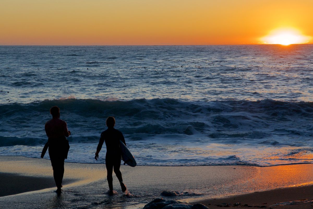
If you enjoy marine life, then Soberanes Point is probably already on your bucket list, as it is a perfect spot to view the cliffs, but the primary reason people come here is to see the beautiful gray whales as they migrate.
If you want to see this, ensure you are visiting in the right season.
Note that encounters with the whales are not guaranteed when you go here, but Soberanes Point is still believed to be one of the best places in the area to catch a glimpse of these beautiful marine giants!
A few miles forward of the Bixby Bridge, you will find a gorgeous beach known as the sandy Garrapata State Beach, which is in the calla Lily Valley.
It is a gorgeous, secluded beach that is ideal for sunbathing, a nice stroll, or for watching time go by looking at the beautiful views of the waves as they collide with the rocky shoreline.
It is a relaxation haven.
Swimming here is not recommended, as it is not totally safe, however, you can spend a nice day by the water here.
However, you should still add this onto your itinerary, and then once you are done here, stop by Rocky Creek Bridge for a photo op, as we will discuss next!
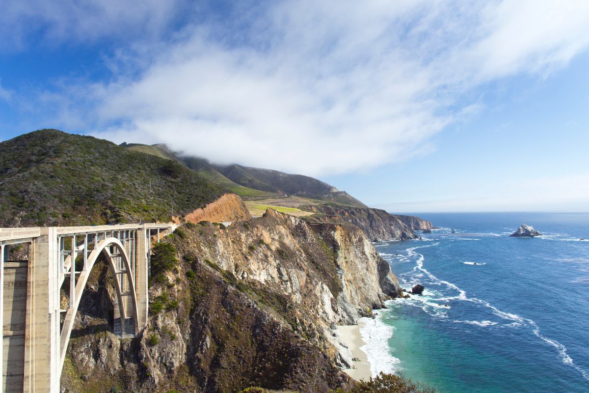
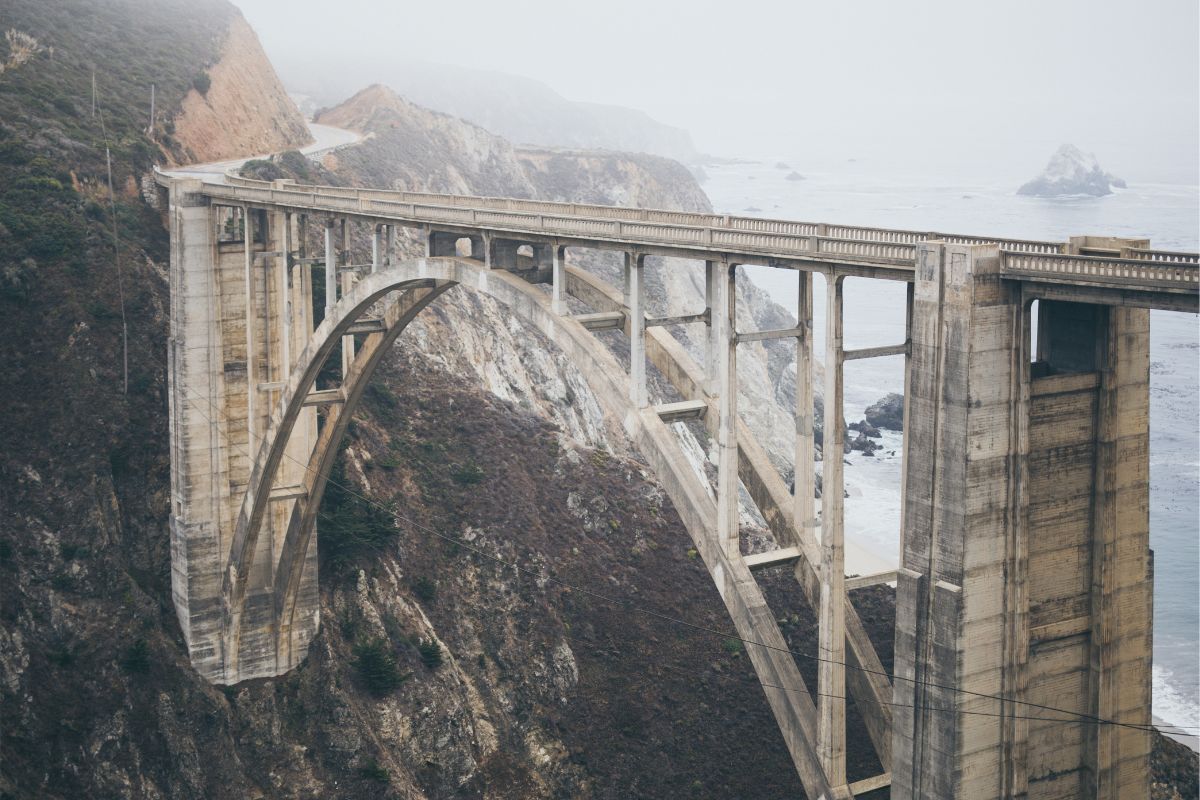
Check Out Bixby Creek Bridge
This ‘bridge’ has a canyon on one side, and gorgeous views of the Pacific on the other side. The views offered by Bixby Creek Bridge are very hard to beat.
It is one of the most infamous landmarks in the Big Sur, and while you get to drive over the bridge as you carry on your journey, you should park up and enjoy the views.
Doing so gives you the perfect opportunity to take some amazing photos, and to be able to take in the truly amazing sights that encompass the bridge!
Perhaps you have a hunger to see some true, raw landscape and really beautiful views of Monterey Bay. If this is the case, then top off in Andrew Molera State Park.
It is the largest state park in the Big Sur, and as you may imagine it offers many different environments for those who enjoy plenty of variety when hiking.
Interestingly, it is not visited as much as the other parks, but this does make it ideal if you want to avoid crowds and enjoy some solo time.
Here you will find perfect beaches, hill tops, meadows, and bluffs.
The best thing to do in this spot is pop your hiking boots on an adventure around the 20 or so miles of trails you can find at the park.
Each hike will provide you with beautiful vistas and unique experiences, from coastal hikes to riverside walks and strolls beneath the huge redwood trees.
If you are new to hiking, the Beach Trail is the easiest, it is a flat hike, and it leads alongside the Big Sur River.
If you enjoy adventuring after relaxing on the beach, go on to Bluff Trail, where you will find the best views of iconic bluffs along the coast.
However, if you would rather a more varied trail, consider East Molera Trail, this gives you the ability to hike among the redwood trees, then walk a ridge with stunning ocean views.
One more thing we love about this place is how aside from the nature it also gives visitors the chance to learn more of the historical and natural heritage of the park.
If you enjoy learning about the history of these areas of the past, go to the Ranch House Museum, where you will see artifact collections from pioneers, as well as artifacts from indigenous peoples and artists who have once called Big Sur home.
You should also take a trip to the Ventana Wildlife Society Discovery Center, here you get a better insight into the wildlife in Big Sur.
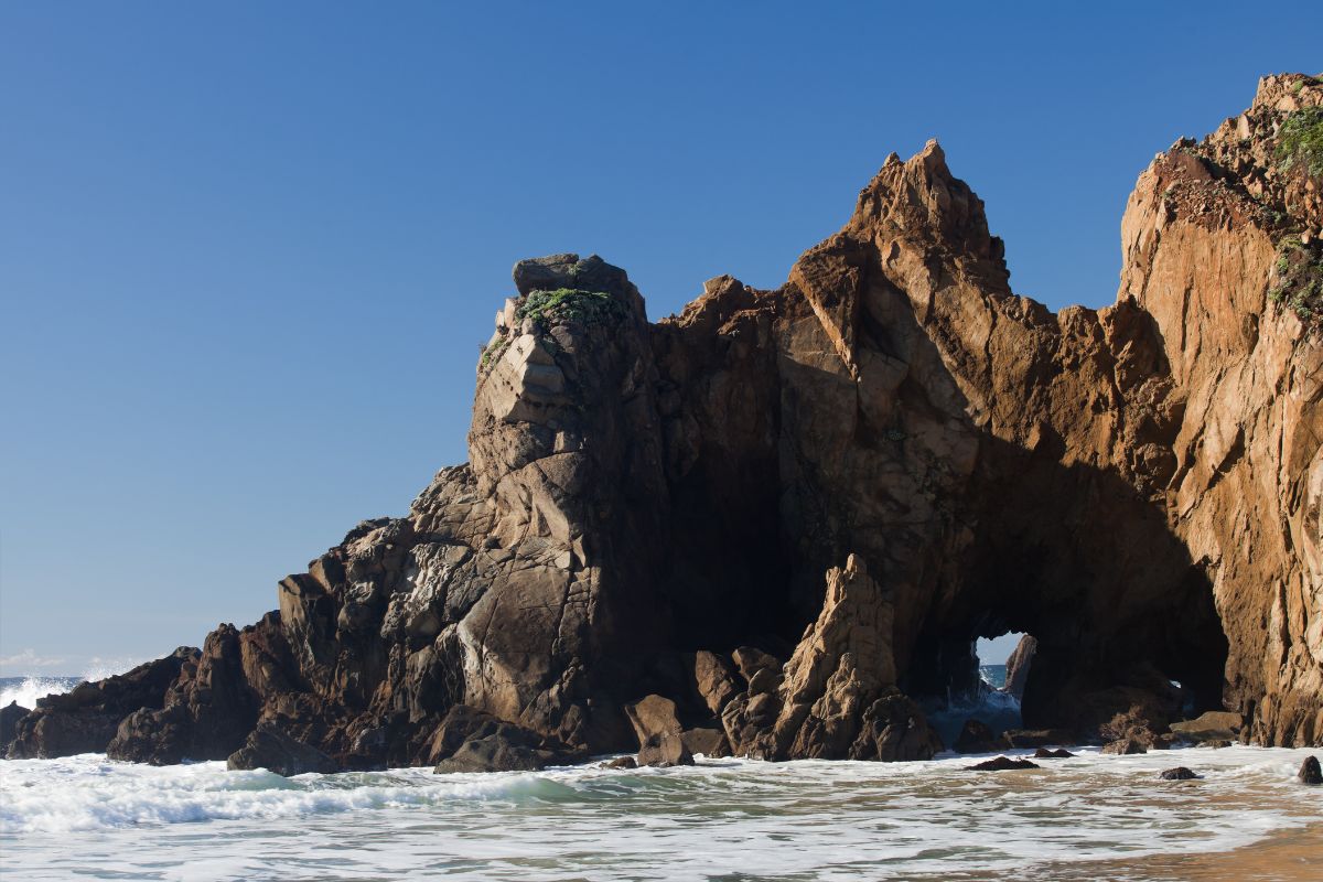
Most of us only expect to ever see purple sand in a fantasy movie, however, you will find it does actually exist, and you will see it yourself if you take a stop off at Pfeiffer Beach, which is by far one of the most amazing beaches on the whole planet.
While Pfeiffer Beach is most infamous for having purple sands, it has more claims to fame than just this.
Another great thing about this beach is the Keyhole Arch, which is a beautiful naturally made arch that is just offshore of the beach.
If you stay here for the sunset, you will be captivated as the last rays of light of the day pass through the arch and create views you could only ever dream of.
Getting to this beach does mean you will need to detour off of the highway a bit, going down some twists, turns, and narrow curves, but once you have made it to the beach it is well worth this detour!
The only downside to this beach is that its location is not actually signposted on the roadside, so you will need to pin it on your map, or pre-set directions on your GPS before your road trip to ensure you get there.
Like the idea of dramatic cliffs, hidden coves, impressive views, and verdant forests alongside the California coastline, well this is just what you will get at this state park.
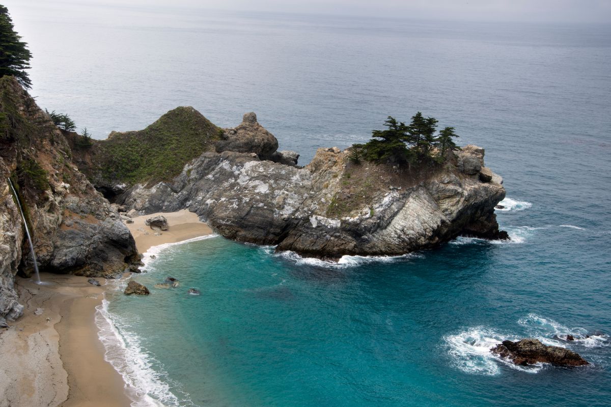
If you only make a single stop on your trip to Big Sur then the Julia Pfeiffer Burns State Park should be that one stop.
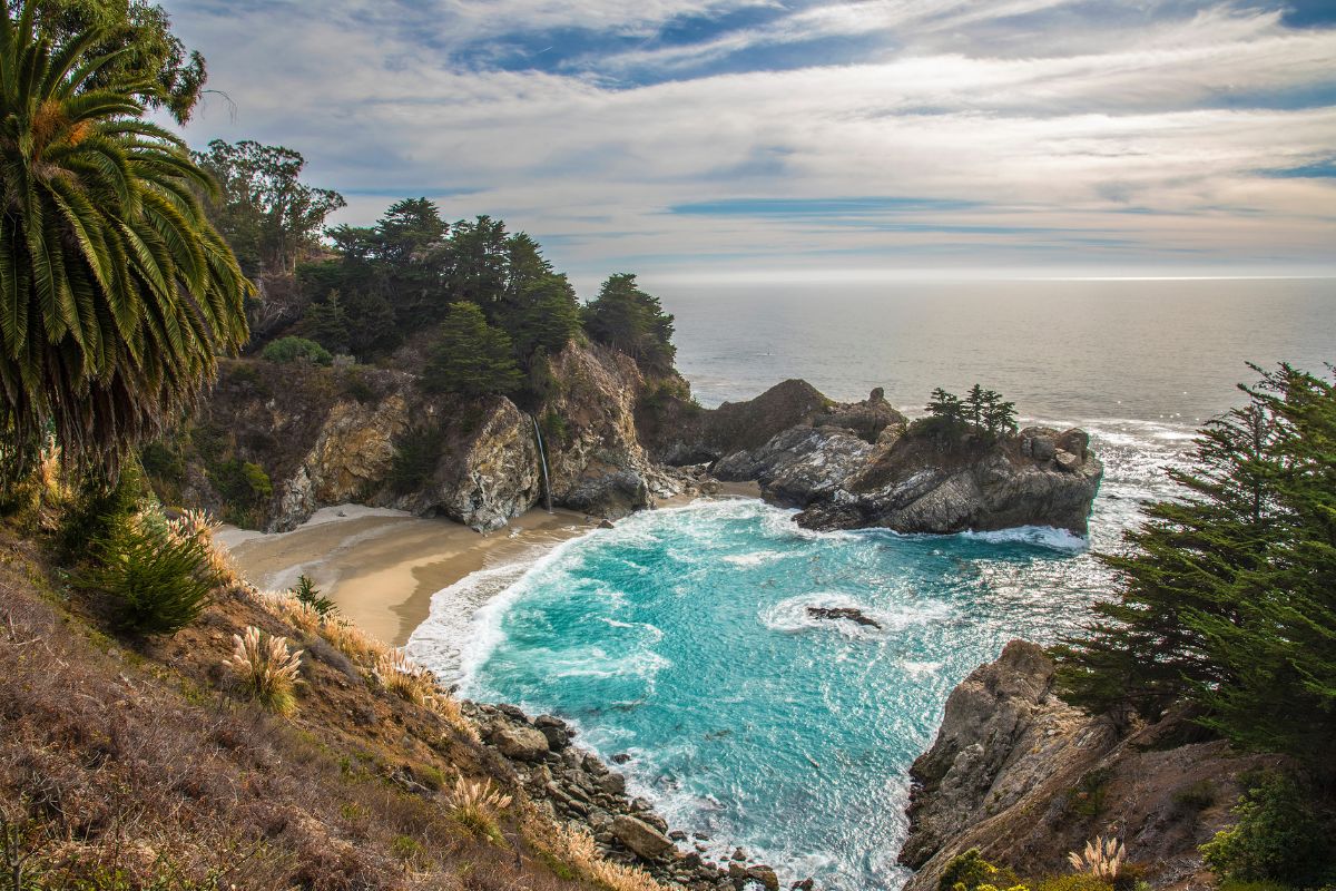
The main highlight of Julia Pfeiffer Burns State Park is McWay Falls, which is also incidentally one of the most iconic sights to see on a trip to Big Sur.
Sure, California is full of plenty of glamorous waterfalls, nothing is quite as eye catching as McWay Falls, which is so beautiful you could easily mistake it for being a painting instead of a landmark.
Why is it so iconic? Well, it is a massive 80 ft waterfall that cascades down a dramatic cliffside into the sea.
However, this technically depends on the tide.
Sometimes it will hit the beach cove, other times the ocean, either way it is captivating!
In order to get to these Falls, you will need to walk a trail.
The Waterfall Overlook Trail is the trail you want to take, don’t worry though, it is only a 0.5 mile long trip to take this trail.
It is also flat and mostly paved, so it is also quite easy to spot when you are driving through Big Sur.
Aside from the falls, you should make the most of all the other things in Julia Pfeiffer Burns State Park.
Walking the trails is a must-do.
The trails offer various landscapes, from jagged bluffs to redwood forests, granite cliffs, miles-long creeks and so much more.
This is also one of the few places along Big Sur where you can go scuba diving, it is also one of the best spots for you to view the marine life up close and personal.
If all of this was not enough to tempt you to come here, it is also one of the best destinations to see migrating gray whales, they tend to enjoy the shores here, and you may even see some enjoying the cove mouth where the falls empty into.
Big Sur is a place that focuses on epic ocean views. However, some spots are landlocked and even these are worth a visit.
Big Sur’s Pfeiffer State park is a good example of a place that is worth a visit if you fancy exploring the side of the highway coated in mountains.
It is found on the west slopes of the Santa Lucia Mountains, it is full of redwood forestry, wildlife sighting opportunities, and riverside hikes.
Fully expect to notice bobcats and black-tail deer here.
If you fancy a hike here, begin with the Pfeiffer Falls Trails, which is a wonderful hike that has you walking in the redwoods before you come to a stunning 60 ft waterfall.
From this area, carry on down the Valley View Overlook Trail, which leads to a viewpoint where you will see Big Sur Valley and even Andrew Molera State Park (yes it is that close!).
While there are no beaches here, you can go swimming in the natural swimming hole.
If you fancy a dip, just walk a few hundred meters or so from the entrance to the park, and you will reach a rocky pool that is a dream to relax your aching muscles in after a long hike1
It is a great place to overnight before you continue your trip, fully equipped with an on-site campground, providing over-nighters with the ability to sleep in this wonderful forest.
However, if you rather more comfort, there are cabins at the Big Sur Lodge.
With amazing views of the coastline of Big Sur, the Monterey Bay National Marine Sanctuary and the redwoods, this State Park is a beautiful location to visit on your road trip to see nature at its best!
In the 80s, Limekiln State Park was the site of a massive limekiln operation (as you may guess from the name).
Limestone used to be harvested from a slope and was then fed into the kilns here.
Thanks to the high heat, pure lime was taken from here, which is very important in making the cement that built the buildings in Monterey and San Francisco.
Sadly, the kilns ended up being abandoned after all the resources were used up, eventually the forest reclaimed the land and made the landscape covered in redwood trees that are seen there today.
Hiking here will give you the ability to see the limekiln ruins left behind, it creates quite the contrast between nature and historical industry.
Apart from this you can also see marine life, go swimming in creeks and at the beach, and go camping here.
Hiking is also a great activity here, since there are 3 canyons that have their own trails here: Limekiln, Limekiln Falls, and Hare Creek Trail.
Each hiking trail is unique, but if you can only fit in one, then you should do the Limekiln Falls trail.
It meets up with the other canyons, which crafts a wide canyon floor covered by beautiful redwood trees.
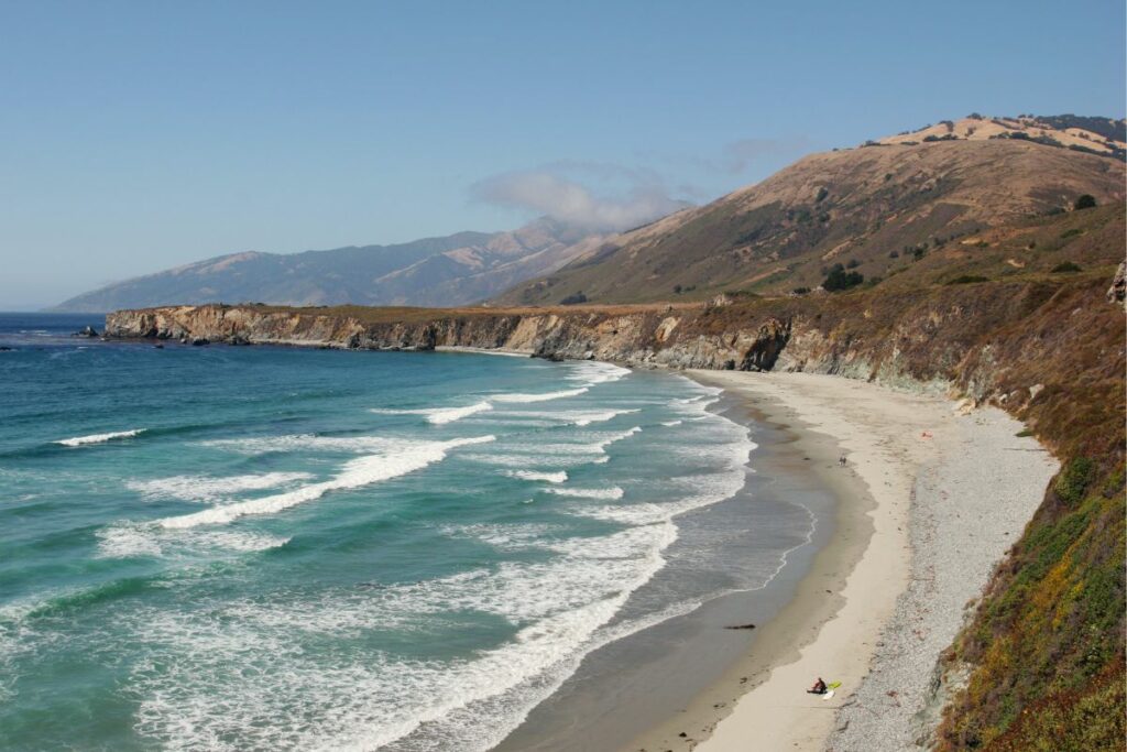
Only 7 miles south of Limekiln State Park you will find Sand Dollar beach.
It is a great place if you are a bit tired of seeing great ocean views but not getting to touch them.
It is well known for having the longest sandy stretch in Big Sur.
It is great for catching waves if you surf, but if you just want to park up, stretch, relax, have a picnic and enjoy the scenery, this is a great spot for that as well!
In spite of how popular it is, it is very rarely crowded, and even if you do visit, and it is busy, the beach is massive, so you will still get a spot to enjoy yourself.
The name of this beach comes from the amount of sand dollars that tend to wash up on the shore here.
While you cannot and should not grab the sand dollars, since they are a very important part of the ecosystem here, you can still go on scavenger hunts to seek out gem-type rocks on the southern side of the beach, where it is rumored that many contain serpentine and jade!
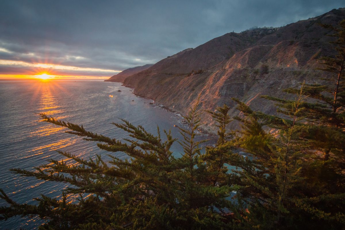
End your road trip with one of the best views on this highway.
While this entire trip is picturesque no matter where you start and end, Ragged Point provides you with some incredible views, enough to have you totally enraptured.
Then, if you are not sick to the teeth of hiking yet, Ragged Point has some epic hiking trails for hikers of every level of experience.
Adventurous hikers can go to Ragged Point Cliffside Trail all the way down to Young Creek.
Once you reach the end you see a black sand beach, which is very different to the views so far.
You will also be greeted by a waterfall. It is a short hike, but requires the right shoes and enthusiasm.
Summary
No matter what order you see these sites in, if you travel North to South or South to North, all of these iconic places are worth a visit.
You don’t need to visit them all, but hopefully, this itinerary has given you an idea of which places to put on your ‘to visit’ list for Big Sur!
Hi, my name is Alex Kallen and I love to travel. Ever since I could afford the ticket, I hopped on a plane and never looked back. I’ve made a living writing travel guides and blogging my experience all over the world.
I want to encourage and inspire others to travel around the US like I am. There’s no need to go on vacation overseas when there is an amazing land of opportunity right on your doorstep. Enjoy my website, I hope to see you out here one day.